Tuesday 6 March 2012

WORLD MAP 19TH CENTURY


[1] Description: Japanese world map from a unknown author dated to 1875, the 8th year of the Emperor's Meiji's reign.


[2]  Description: Charles Desilver's world map, published in his New Universal Atlas 1856/USA.


[3]  Description: World map made by the English cartographer, engraver and publisher Aaron Arrowsmith in 1812.

[4]  Description: Map of the world centered on America prepared by the American altlas publisher Joseph Hutchins Colton in 1852.


[5]  Description: Japanese world map in two hemispheres dating to 1848 by Shincho Kurihara and Heibe Chojiya.


[6]  Description: Political world map illustrated by the English artist Walter Crane showing the extent of the British Empire in 1886.


[7]  Description: Dutch world map from Otto Petri published in 1860.


WORLD MAP 18TH CENTURY


[1]  Description: World map created by the German or Dutch cartographer Herman(n) Moll in 1709.

[2]  Description: World map (1745) from an unknown author.


[3]  Description: World map from the French cartographer Nicolas de Fer, published in 1722.


[4]  Description: The so-called "Zheng He map" is a Chinese world map, probably produced in 1763 at the base of Zheng He's voyages.


 [5]  Description: Engraved world map by the German cartographer Leonhard Euler first published 1753 in his school atlas "Geographischer Atlas".


[6]  Description: World map with the trade winds from the German or Dutch cartographer Herman(n) Moll first published in England 1719. Picture from Atlas Minor, 3rd edition, London 1736.


WORLD MAP 17TH CENTURY


[1] Description: Foldable map of the world, contained in "The world encompassed by Sir Francis Drake...", London 1628.


[2] Description: Decorative maps of the world from the French cartographers Nicholas Sanson and Alexis Hubert Jaillot published in 1691


[3] Description: Exceptional map of the world made in 1650 by the Dutch publisher Jan Jansson (Johannes Janssonius). Such maps, showing comtemporary geopraphy with ancient place names, were popular in the post-renaissance period.


[4]  Description: World map by the Dutch-German cartographer Andreas Cellarius published in 1661.


Monday 5 March 2012

WORLD MAP 16TH CENTURY


[1]  Description: World map published in 1589 by the Dutch cartographer and engraver Gerard de Jode.


[2]  Description: World map of the Portuguese cartographer Domingo Teixeira drawn in 1573 with the sea routes of Vasco da Gama and Hernando de Magallanes. Moreover the map shows the the meridian of Tordesillas, which devided the new discovered lands between Spain and Portugal.

[3] Description: World map made by the French mapmaker Guillaume Brouscon in 1543.

[4]  Description: "Theatrum Orbis Terrarum" (Theatre of the World) made by the Flemish cartographer and geographer Abraham Ortelius in 1570, who is generally recognised as the creator of the first modern atlas.


[5] Description: World map made by Laurent Fries, woodcut 1522.


[6] Description: The Caverio Map (also called Caveri Map or Canerio Map) is a world map drawn by the Genoese cartographer Nicolay de Caveri, circa 1505.


[7]  Description: Orbis Terrarum published by the Dutch astronomer, cartographer and clergyman Petrus Plancius in 1594.

[8]  Description: Map of the world 1552 by the Siebenbuerger Saxon humanist and Protestant Reformer Johannes Honterus.

[9]  Description: "Orbis Terrarum" from the Dutch astronomer, cartographer and clergyman Petrus Plancius, published in 1590.


[10]  Description: "A Chart of the World on Mercator's Projection", also known as the Wright–Molyneux Map. This Map is the first world map produced in England and based on the projection of the English mathematician and cartographer Edward Wright.


[11]  Description: World map of the Dutch explorer, cartographer, astronomer and painter Johannes Ruysch published in 1507. Ruysch's work is the second oldest known printed map showing the New World.


[12] Description: World maps of the Northern and Southern hemisphere published in 1593 by the Dutch cartographer and engraver Gerard de Jode.

WORLD MAP 15TH CENTURY


[1]  Description: T-O world map based on the medieval world view of the Spanish Archbishop Isidore of Seville (c. 560-636), published between 1459-1463 in La Fleur des Histoires by Jean Mansel.

[2]  Description: World map of the German cartographer Andreas Walsperger made in 1448.


  [3]  Description: The "Genoese map" is a world map from an unkown Italian cartographer made in 1457.


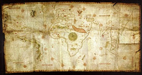
[4]  Description: The "Columbus map" which perhaps was drawn by Christopher Columbus and his brother Bartolomeo in Lisbon around 1490 before the discovery of the New World, showing the known world in their time.


[5]  Description: Historical world map from Johannes de Armsshein, published in 1482 in Ulm/Germany at the base of Ptolemy's view of the world.


[6]   Description: World map of Hartmann Schedel published in the Schedel's World Chronicle in 1493 showing Europe, Asia and Africa. Schedel (1440-1540) was a German physician, humanist and historian, one of the first cartographers who used the printing press.


[7]  Description: World map made between 1457 and 1459 by the Venetian monk Fra Mauro. The map is a circular planisphere drawan on parchment and set in a wooden frame.


Detail Europe

WORLD MAP 14TH CENTURY


[1]  Description: The Catalan Atlas produced in 1375 by the Majorcan cartographers Abraham and Jehuda Cresques is the most important Catalan world map of the Middle Ages. The world map originally consisted of various leaves.

Europe
Middle East

East Asia
[2]  Description: World map made around 1420 by the Italian cartographer Pietro Vesconte.


[4]   Description: The Hereford Mappa Mundi is a world map dating to ca. 1300, derived from the T and O maps and the largest known medieval map.

WORLD MAP 13TH CENTURY


Description: "Psalter World Map" is a detailed T-O Map drawn by an unknown author around 1260.

]\

WORLD MAP 12TH CENTURY


[1]  Description: World map made in 1190 by the German or Burgundian theologian Honorius Augustodunenesis, also known as Honorius of Autun.


[2]   Description: World map from the Italian monk Beato di Liebana, made in the 12th century.


[3]  Description: World map made by the Arab cartographer and geographer Abu Abd Allah Muhammad al-Idrisi in 1154 under the court of King Roger II of Sicily.

WORLD MAP 11TH CENTURY


[1] Description: "Cotton" of Anglo-Saxon world map (c. 1040) appears in a copy of a classical work on geography (British Library; Cotton MSS, Tib. B. V, folio 56.)

[2] Description: World map of Mahmud al-Kashgari. Turcocentric world map published in al-Kashgari's "Compendium of the languages of the Turks" in the 11th century. The map is oriented with east on the top and the world is shown as encircled by the ocean.

WORLD MAP 2ND CENTURY


Description: Ptolemy world map ca. 150 AD. Claudius Ptolemaeus (Ptolemy), was a mathmatician, geographer, astronomer and astrologer who lived in the Hellenistic culture of Roman Egypt. One of his main works is his Geographia, a compilation of the known geography in the Roman Empire. This map is a reconstruction made in the 15th century.

WORLD MAP 4TH CENTURY

                                      Description: The Tabula Peutingerian This Roman map of the acient world shows the road network in the Roman Empire in the 4th century and covers Europe, parts of Asia (India) and North-Africa.
             WORLD MAP SEVENTH CENTURY....@


 Description: T-O map from the 7th century, the early Middle Ages, with the description of the world according the Etymologiae of Isidore of Sevilla, who was Archbishop of Seville/Spain for more than three decades. This T and O map is a copy from the 12th century.

                                                   WORLD MAP 6TH CENTURY

Babylonian map of the world, ca 600 BC
The Babylonian Map of the World is diagrammetic labelled  depiction of the known world from the perspective of Babylonia. The map is incised on a claytablet, showing Babylon somewhat to the north of its center.
It is usually dated to the 6th century BC. It was discovered at sippar, southern Iraq, 60 miles (97 km) north of Babylon on the east bank of the Euphrates river, and published in 1899.The clay tablet resides at the British Museum.